Krakow Maps and Orientation
(Krakow, Malopolskie, Poland)
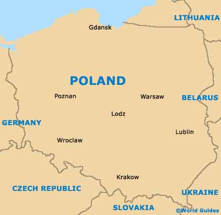
One of the most historic of all the cities in Poland, Krakow is sited on the southern side of Poland and boasts a population of around 800,000. First established more than 1,300 years ago and once Poland's capital, Krakow has understandably become one of the country's leading tourist destinations and is based around the Vistula River.
Krakow is an easy city to explore, whether or not you choose to bring a map. Much of the sightseeing is to be found within the Old Town area, a historic quarter brimming with interest and a number of eye-catching consulate buildings.
Maps and Orientation of the City
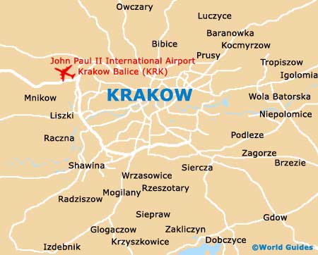
Old Town Krakow is centred around the Main Market Square, which is always a good point of reference and a popular meeting place. The district is surrounded by the tranquil Planty Park, a notable green strip, which began its life many years ago as an actual moat.
The southerly side of Krakow's Old Town area is home to a wealth of local landmarks, such as Wawel Castle. Nearby, the district of Kazimierz is also worth exploring. Most visitors to Krakow arrive at either the railway station or bus station, which are located on the north-easterly outskirts of the Old Town area. Many hotels are close by, together with taxi ranks for those needing to travel further afield.
- Chrzanow - north-west
- Czernichow - south-west
- Iwanowice - north
- Koniusza - north-east
- Krzeszowice - north-west
- Liszki - west
- Michalowice - north
- Myslenice - south
- Siepraw - south
- Skala - north
- Skawina - south-west
- Swiatniki Gorne - south
- Wieliczka - south-east
- Wielka Wies - north-west
- Zabierzow - north-west
- Zielonki - north
Map of Poland
Map of Krakow